Route
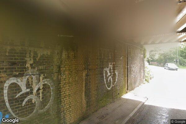
ALLBROOK ROAD
low bridges, 3.68 m clearance, low bridge, bridge clearance
Southern
Last verified
27 Mar 2026
Information
Restriction
- Hazard category
- low bridges
- Road
- ALLBROOK ROAD
- Location
- ALLBROOK ROAD
- Clearance
- 3.68 m
- Clearance (imperial)
- 12' 1"
- Maximum width
- This will become available as we collect more information
- Maximum weight
- This will become available as we collect more information
- Problem type
- low bridge
- Restriction type
- bridge clearance
- Standard coach affected
- This will become available as we collect more information
- Single-decker affected
- YesConfirmed
- Double-decker affected
- YesConfirmed
- Buses and coaches affected
- This will become available as we collect more information
- Coaches affected
- This will become available as we collect more information
- Signposted
- YesConfirmed
Operational notes
- Description
- Signed height from the Network Rail bridge height workbook. Verify local bridge signage before coach travel.
- Alternative route
- This will become available as we collect more information
- Reported by
- Network Rail bridge height workbook
Images
 Google Street View
Nearby places
Closest places of other types within 5 mi.
Hotel0.4 mi
Travelodge Southampton Eastleigh
Travelodge
Hotel1.3 mi
Travelodge Eastleigh Central
Travelodge
Hotel1.6 mi
Premier Inn Southampton (Eastleigh)
Premier Inn
Attraction2.7 mi
Marwell Zoo
zoo or wildlife park
Hotel2.8 mi
Premier Inn Southampton Airport
Premier Inn
Rest stop5.0 mi
Rownhams Services
Roadchef, M27
Nearby route warnings
Mapped route warnings in this area. Always confirm local signage and coach access before travel.
Route2.5 mi
SHAWFORD (WIDENED LINES)
low bridges, 4.11 m clearance, low bridge, bridge clearance
Route3.4 mi
SWAYTHLING ROAD
low bridges, 3.4 m clearance, low bridge, bridge clearance
Route3.8 mi
AMPFIELD BRIDGE (POUND LANE)
low bridges, 3.28 m clearance, low bridge, bridge clearance
Route4.4 mi
KENT ROAD
low bridges, 2.67 m clearance, low bridge, bridge clearance