Route
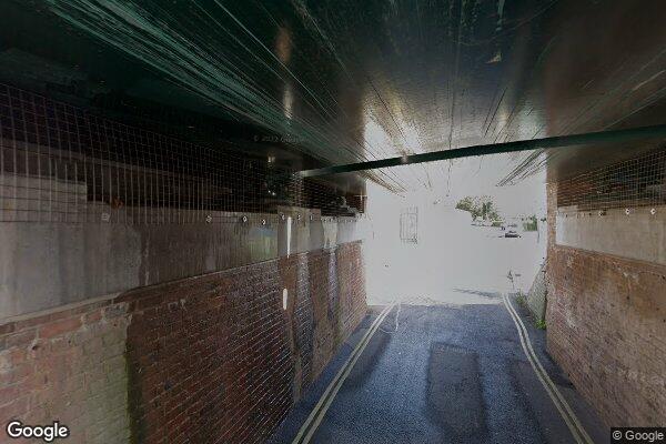
COW LANE
low bridges, 2.9 m clearance, low bridge, bridge clearance
Southern
Last verified
27 Mar 2026
Information
Restriction
- Hazard category
- low bridges
- Road
- COW LANE
- Location
- COW LANE
- Clearance
- 2.9 m
- Clearance (imperial)
- 9' 6"
- Maximum width
- This will become available as we collect more information
- Maximum weight
- This will become available as we collect more information
- Problem type
- low bridge
- Restriction type
- bridge clearance
- Standard coach affected
- This will become available as we collect more information
- Single-decker affected
- YesConfirmed
- Double-decker affected
- YesConfirmed
- Buses and coaches affected
- This will become available as we collect more information
- Coaches affected
- This will become available as we collect more information
- Signposted
- YesConfirmed
Operational notes
- Description
- Signed height from the Network Rail bridge height workbook. Verify local bridge signage before coach travel.
- Alternative route
- This will become available as we collect more information
- Reported by
- Network Rail bridge height workbook
Images
 Google Street View
Nearby places
Closest places of other types within 5 mi.
Hotel0.6 mi
Premier Inn Portsmouth North Harbour
Premier Inn
Hotel1.2 mi
Travelodge Portsmouth Hilsea
Travelodge
Hotel2.2 mi
Travelodge Portsmouth
Travelodge
Hotel3.1 mi
Travelodge Portsmouth City Centre
Travelodge
Hotel3.1 mi
Premier Inn Portsmouth (Havant)
Premier Inn
Hotel3.3 mi
Premier Inn Portsmouth Dockyard
Premier Inn
Nearby route warnings
Mapped route warnings in this area. Always confirm local signage and coach access before travel.
Route1.7 mi
PORTCHESTER FARM (PORTSDOWN ROAD)
low bridges, 2.67 m clearance, low bridge, bridge clearance
Route2.0 mi
STATION ROAD (PORTCHESTER) HILL ROAD
low bridges, 3.6 m clearance, low bridge, bridge clearance
Route3.1 mi
Portsmouth Clean Air Zone
clean air zones
Route3.2 mi
LANDPORT VIADUCT (PORTSMOUTH & SOUTHSEA)
low bridges, 2.9 m clearance, low bridge, bridge clearance