Route
NOC /38 (ALSO SMJ2/1) LUNNFIELDS LANE
low bridges, 4.27 m clearance, low bridge, bridge clearance
Eastern
Last verified
27 Mar 2026
Information
Restriction
- Hazard category
- low bridges
- Road
- NOC /38 (ALSO SMJ2/1) LUNNFIELDS LANE
- Location
- NOC /38 LUNNFIELDS LANE
- Clearance
- 4.27 m
- Clearance (imperial)
- 14' 0"
- Maximum width
- This will become available as we collect more information
- Maximum weight
- This will become available as we collect more information
- Problem type
- low bridge
- Restriction type
- bridge clearance
- Standard coach affected
- This will become available as we collect more information
- Single-decker affected
- UnknownCheck directly
- Double-decker affected
- YesConfirmed
- Buses and coaches affected
- This will become available as we collect more information
- Coaches affected
- This will become available as we collect more information
- Signposted
- YesConfirmed
Operational notes
- Description
- Signed height from the Network Rail bridge height workbook. Verify local bridge signage before coach travel.
- Alternative route
- This will become available as we collect more information
- Reported by
- Network Rail bridge height workbook
Images
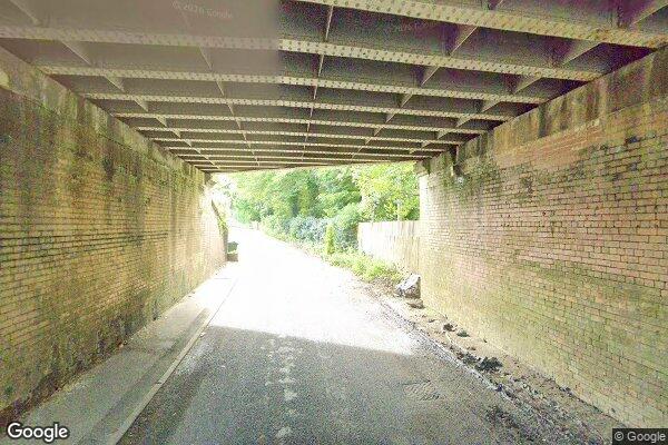 Google Street View
Nearby places
Closest places of other types within 5 mi.
Nearby route warnings
Mapped route warnings in this area. Always confirm local signage and coach access before travel.
Route1.4 mi
Low Street, Brotherton
low bridges, 4.4 m clearance, low bridge, bridge clearance
Route2.2 mi
SMJ2/12 PONTEFRACT ROAD, FERRYBRIDGE
low bridges, 3.73 m clearance, low bridge, bridge clearance
Route3.2 mi
WATER LANE
low bridges, 3.81 m clearance, low bridge, bridge clearance
Route3.5 mi
Monkhill Lane, Pontefract
low bridges, 3.43 m clearance, low bridge, bridge clearance